Franklin County Engineer Facebook Feed

Franklin County Engineer

As a local public works agency headquartered in Columbus, Ohio, the Franklin County Engineer's Office is responsible for the maintenance and construction of 271 miles of county roadway and 351 county bridges, as well as upkeep of all county ditches, drains, retention basins, and other storm water facilities within the right-of-way of county roads in unincorporated areas. To meet the continuing development and infrastructure needs of Franklin County, the Engineer's Office utilizes the latest technologies for determining and maintaining roadway centerlines and boundaries; retracing and setting new monuments for original public land surveys; preparing geographic information system mapping for real estate tax assessments; and establishing precise countywide horizontal and vertical control to maintain uniformity in construction, surveying, and mapping.
Franklin County Engineer
Work is progressing on the Trabue Road over Scioto River and Trabue Road over Scioto Pointe Drive bridge replacement project. Complete General Construction is currently executing Phase 1, which will extend through July, 2025. Substantial completion is anticipated in October 2026. Stay tuned for more updates as work continues!
Franklin County Engineer
Harrisburg Georgesville Road, between Gay Road and Harrisburg London Road, is now open to traffic.
Franklin County Engineer
Groveport Road, between Lithopolis Road and Gender Road, is now open to traffic.
Franklin County Engineer
Harrisburg Georgesville Road between Gay Road and Harrisburg London Road is closed due to high water. The road will remain closed until the water has subsided.
Franklin County Engineer
Today is National Read a Road Map Day! Maps do more than show us where we’re going, they reflect the planning, engineering, and community input that shape how we move through Franklin County. From road improvements to stormwater systems, every project starts with a plan. #ReadARoadMapDay
Franklin County Engineer
Groveport Road, between Lithopolis Road and Gender Road, is closed due to high water. The road will remain closed until the water has subsided.
Franklin County Engineer's Office
970 DUBLIN ROAD
COLUMBUS, OHIO 43215
(614) 525-3030
fracoeng@franklincountyengineer.org

Follow Us

Top
 

Historical Maps and Information

Historical Maps and Information

Historical maps of Franklin County dating back to 1842, as well as township maps, road record books, subdivision plats, private surveys, county road construction plans, and county road right-of-way plans are housed in the Records Management Office of the Surveying Department. Copies of these records and others are available to the public free of charge or for a nominal fee. Most can be obtained in both hardcopy and digital format. For more information, please contact Glenn Thompson, Records Analyst at (614) 525-3045.

Historical Map examples:

1856 Property Map of the city of Columbus

Map

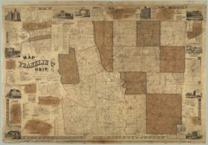
1883 Property Map of Franklin County, Ohio

Franklin County Map

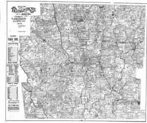
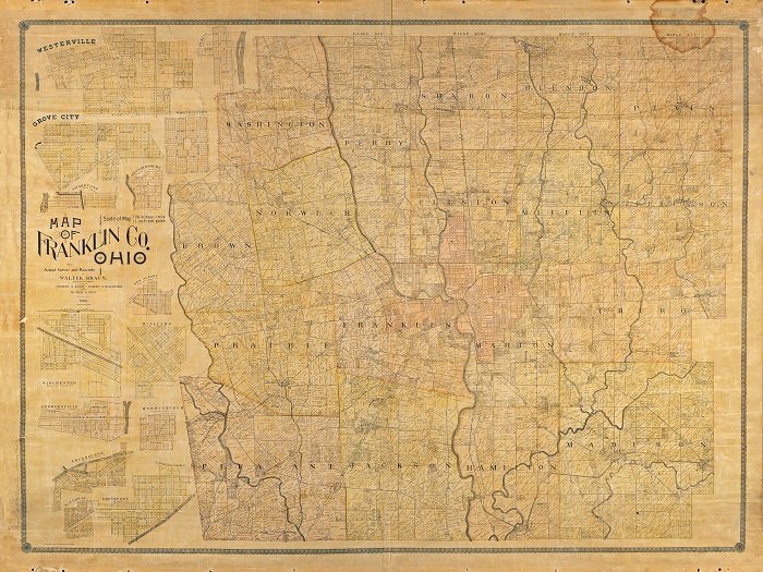
1895 Property Map of Franklin County, Ohio

Map